
Temple ZIP Coverage and Postal Status
The research separates postal associations actually observed in current PostalPro material from older or service-list references. That distinction matters. The current material associated 76501, 76502, and 76508 with TEMPLE TX 76501. Older USPS material grouped 76501 through 76505 and 76508 under Temple TX 76501. This table does not turn every historic listing into a current delivery claim. It records the source status so a researcher can verify an active label with current USPS material.
| ZIP | Temple association in research | Postal reference | Use with care |
|---|---|---|---|
| 76501 | Current USPS Temple association observed; core Temple postal area | USPS facility or pilot material uses 401 N. Main, Temple TX 76501 | Still a postal designation, not a city-limit line |
| 76502 | Current USPS Temple association observed | Current PostalPro material associates it with TEMPLE TX 76501 | Do not infer a neighborhood or municipal boundary from the label |
| 76508 | Current USPS Temple association observed | Current PostalPro material associates it with TEMPLE TX 76501 | Confirm a current address through USPS before relying on it |
| 76503 | Historical or state-list association | Appears in older USPS or state material | Active status requires current AIS confirmation |
| 76504 | Historical or service-material association | Older and current service material may differ | Keep delivery association separate from city boundary |
| 76505 | Historical association | Appears in the archived USPS table | Active assignment requires a current lookup |
Nearby 76513 is associated with Belton and nearby county geography, while 76557 and 76579 appear as nearby ZCTA context in Census-related material. None of those labels alone proves that an address is in Temple.
Temple Postal Checks Before Historical Lists
The archived and current USPS sources are both useful, but they answer different questions. The archived table documents a historical grouping. The current PostalPro result supplies the narrower observed association. When a historic directory, deed, or map predates modern postal labels, record that fact instead of forcing a modern ZIP onto an old address. This comparison is a Temple records quirk: an apparently simple list can mix old service references with an active delivery label if its source date is ignored.
The archived USPS Temple ZIP grouping table is the source illustrated here, and it should be read as historical material rather than as a current-address answer.
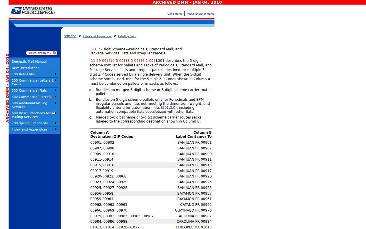
This archived view explains why a Temple postal note needs its source date beside it: the older grouping is broader than the current association observed in PostalPro material.
Finding Residents by Temple ZIP
A ZIP can narrow the geography for a Temple research task, but it does not produce a complete resident list from Bell CAD or the voter system. First establish the active postal designation through current USPS resources. Next use the postal or ZCTA boundary as a geography layer, then locate addresses or parcels through Bell CAD and the GIS viewer. Finally, use the parcel's situs, legal description, and recorded-instrument trail for the specific address question. The point is to make each step reproducible without treating a delivery zone as personal information.
- Label the starting geography as a current USPS postal ZIP, a historical list, or a Census ZCTA.
- Confirm a specific delivery address through current USPS resources before relying on the five-digit label.
- Use Bell CAD's address, owner, ID, or GIS paths to find the parcel connected with a verified address.
- Compare the CAD situs with the mailing line and recorded legal description rather than assuming they mean the same thing.
- When the question narrows to one road, continue with the Temple street-by-street records walkthrough.
Texas voter material is not a ZIP-filter shortcut for a directory. Bell County Elections and the Texas Secretary of State provide status, precinct, application, and public-information channels with confidentiality protections. A directory page should link to those official routes, not republish protected address information.
Temple Search Fields and Bell CAD ZIP Limits
The inspected Bell CAD form has no visible ZIP field. Its search modes are Search, By Owner, By Address, By ID, ARB Search, and Advanced Search. A ZIP-wide result therefore cannot be created by finding a hidden CAD filter. Use the postal geography to organize the work, then use CAD's actual fields to find individual addresses or parcels. The table below distinguishes the observed controls from functions that were not documented in the research.
| Source | Observed search path | Good Temple input | ZIP boundary |
|---|---|---|---|
| Bell CAD property search | By Address, By Owner, By ID, and Advanced Search | Street number or name, owner name, property ID, geographic ID, subdivision, neighborhood, or property type | No visible ZIP field was inspected |
| Bell CAD Interactive Maps | Locate an address or parcel; inspect available parcel, road, or orthophoto layers | Address or parcel identifier | Live layer names and boundary controls were not exposed in the research |
| USPS current resources | ZIP lookup and AIS resource route | Use for current postal verification and keep a retrieval date | No detailed field list was captured in the research |
| Census profile material | ZCTA profile or map context | Statistical geography only | A ZCTA is not a USPS delivery route or address-verification tool |
Bell CAD lists its Temple office at 205 E. Central Ave. and its main office in Belton. Its online record is for research and should be verified for legal purposes. The appraisal record can provide parcel context, but it cannot resolve the current postal assignment by itself.
Temple ZIP Boundaries and City Limits
A ZIP is a USPS delivery convention. Temple is the municipal authority for city limits. Bell CAD is the appraisal and parcel source. The Census uses ZCTAs as generalized statistical approximations. These boundaries can overlap, but they are not interchangeable. A route can use a Temple postal city outside the corporate limit, and a parcel's owner mailing city can differ from its situs. Identify the authority for each field before comparing results.
- ZIP and ZIP+4
- A five-digit ZIP is a broad postal designation. ZIP+4 is a more specific delivery segment, not a separate city boundary.
- Post-office-box ZIP
- A postal designation used for post-office boxes. It should not be treated as the physical situs of a parcel.
- Unique ZIP
- A ZIP assigned for a specific delivery purpose or institution. No such Temple assignment is assumed here without current USPS confirmation.
- Carrier route
- A postal delivery grouping. It is not a municipal border or a complete resident record.
Temple Mailing and Situs Labels Must Stay Separate
Bell CAD may show an owner of record, a property situs, a mailing address, a legal description, account identifiers, and tax-year information. The mailing address can be outside Temple or Bell County. A Temple mailing city can also appear on a parcel outside the city limits. For address research, preserve the exact mailing line and physical situs as separate fields, then use the deed index for the legal parcel trail. Do not correct one agency's label by borrowing a different agency's geography without evidence.
This distinction also protects the meaning of a result. A CAD owner record is owner data, not proof of an occupant. An instrument records a title event, and the recording date may lag occupancy. A postal line records delivery geography. Each source has a narrow but useful role.
Temple ZIP Geography Is Not a Census ZCTA
The Census QuickFacts FAQ for Temple says QuickFacts does not contain postal ZIP Codes and uses generalized ZIP Code Tabulation Areas. A ZCTA is a statistical approximation, not a USPS route and not the Temple corporate limit. Census-associated material can be helpful for describing broader geography, including related ZCTAs such as 76501, 76502, 76504, 76508, 76513, 76557, and 76579. It should not be used to verify a delivery address or to redefine a city boundary.
This is a comparison worth making explicit in any Temple ZIP research note. Label results as USPS postal, Census ZCTA, CAD address search, or Temple city-limit parcel. Mixing those modes without a mismatch note can produce an answer that looks precise but is not reproducible.
Temple ZIP Code Directory Sources for Current Delivery
For a current delivery question, use current USPS resources rather than an archived city list. The USPS ZIP basics material explains the role of ZIP+4, while the AIS Viewer route provides official address-information-system resources. Save the retrieval date because postal service assignments change. Bell CAD and the City of Temple should then be consulted only for the parcel or municipal question each custodian actually holds.
The official USPS AIS resource page is shown below as the current-information route identified in the research.
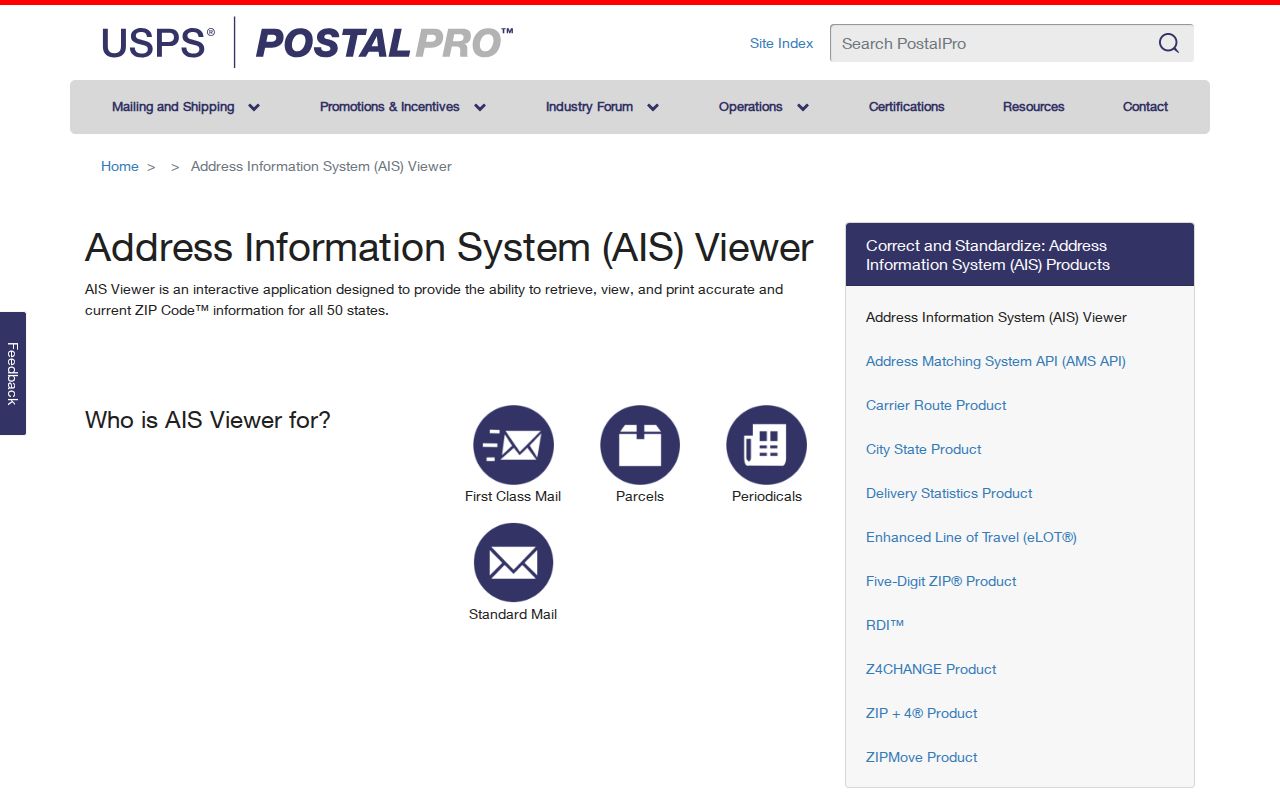
The AIS route supports an up-to-date postal check, while the archived table remains useful as dated background for older Temple material.
Temple ZIP Research Notes for Street-Level Work
A careful Temple ZIP code directory note identifies the source, date, and geography before it names an address. Test mismatches rather than hiding them: a Temple mailing line with an owner elsewhere, a post-office box, an address outside city limits using a Temple postal city, a ZIP+4 label, an annexed street with an older city line, or a historic entry that predates ZIPs. These are research conditions, not proof that one office is wrong.
For a historical block, the 1893 Temple Sanborn set and the 1922 sheet 18 record can help compare lot, block, and built form with later postal labels. For a present address, use USPS for delivery, Bell CAD for appraisal and parcel context, Temple for municipal authority, and Census material for statistics. The ZIP code directory is most useful when it keeps those custodians separate.